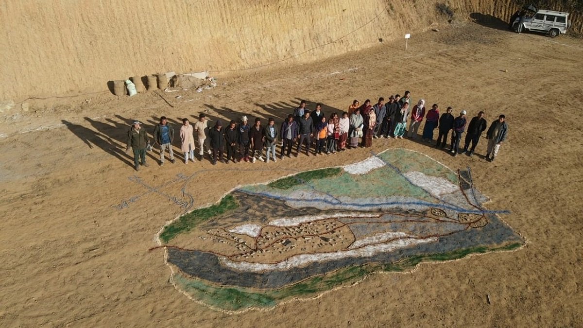
In an effort to rejuvenate and revive degraded areas and at the same time to improve livelihood of the people around Barak watershed, Senapati Forest Division, Manipur today as a pilot initiative carried out a PRA (Participatory Rural Appraisal) exercises to map the resources, land use patterns, wealth rankings, matrix ranking, timeline and SWOT analysis of the Saranamai village, Senapati under Barak catchment areas.
The baseline data would help in formulating detailed plan of action under new CAMPA scheme from MoEFCC. The division plans to cover all the villages falling under Barak watershed in the days to come.
It may be mentioned that Barak River is of great importance due to its ecological, hydrological, environmental, religious-cultural, spiritual, and economic aspects in and around Senapati District. Barak river with its origin at Liyai Khullen village of Senapati District, flows through Manipur and further drains to plains of lower part of Assam and finally in Bay of Bengal as river Meghana in Bangladesh. The Barak basin is a part of the greater Ganga-Brahmaputra River system and is the second largest basins in North-East India. It has several tributaries such as Makru, Irang, Tuivai, etc.
The Barak basin and its tributaries along with its catchment area are of great significance and have enormous potential in terms of overall ecology and socio-economic perspective. The significance however has been undermined of late due to various increasing threats and problems viz.., forest fire, floods, bank line erosion, deforestation, and degradation, shifting cultivation, soil erosion in catchment areas, landslides, lack of awareness etc. To mitigate all these issues and threats, an integrated and multi-tiered approach for rejuvenating the river and its watershed through forestry intervention is required.